
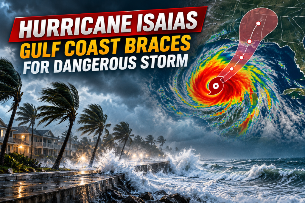
Hurricane Isaias became the first hurricane of the Atlantic season late Wednesday and is now heading for the northern Gulf Coast. Forecasters expect landfall late Friday or early Saturday. By Thursday morning, CNN reported that the storm had maximum sustained winds of 80 mph, and officials in several states were rushing to prepare.
The storm is expected to bring dangerous storm surge, heavy rain, damaging winds and isolated tornadoes to parts of Louisiana, Mississippi, Alabama and the Florida Panhandle. Alabama and Florida have declared states of emergency, some schools will close Friday, and about a quarter of Gulf oil output has been paused.
Where Hurricane Isaias Stands Now
The storm formed as a tropical storm on Wednesday in warm water off eastern Mexico. It strengthened quickly, according to PBS News, citing the Associated Press. National Hurricane Center Director Michael Brennan said it could reach major Category 3 strength, meaning winds of 111 mph or more, before reaching land.
The latest National Hurricane Center advisory said the storm was moving east-northeast at about 9 mph. It is expected to turn north later Thursday and Friday. Hurricane Hunter aircraft were investigating the system, and forecasters said it should remain a strong hurricane as it nears the coast.
Forecasts for Hurricane Isaias differ slightly on peak strength. CNN meteorologists described a possible high-end Category 2 on Thursday night, while another CNN update said it could near Category 3 before weakening somewhat ahead of landfall.
Storm Surge, Rain and Tornado Risks
For Hurricane Isaias, the hurricane center said a Hurricane Warning covers Ocean Springs, Mississippi, to the Bay/Gulf County line in Florida. A Storm Surge Warning runs from the mouth of the Mississippi River to the Steinhatchee River in Florida. Tropical-storm conditions should begin Friday, with hurricane conditions Friday night into early Saturday.
Surge heights
Forecasters said surge combined with high tide could put 5 to 7 feet of water above ground from Ocean Springs to Indian Pass and in Mobile Bay. Areas from Indian Pass to the Steinhatchee River could see 4 to 6 feet. The deepest water is expected near and east of where the center comes ashore.
Rain and flooding
From Friday through the weekend, 3 to 7 inches of rain are expected from far southeastern Louisiana to the Florida Panhandle, with isolated totals near 10 inches. Rain of 1 to 3 inches could reach as far north as the Tennessee Valley and the Carolinas, raising the risk of flash flooding.
Tornadoes and inland power outages
Isolated tornadoes are possible Friday night in coastal Alabama and the Panhandle. The threat continues Saturday for eastern Alabama, western Georgia and the Panhandle. CNN meteorologists also said gusts of 30 to 40 mph could cause scattered outages in central and northern Alabama, northern Georgia and northeast Mississippi.
Emergency Declarations and Evacuations
Alabama Gov. Kay Ivey declared a state of emergency for 40 counties. Florida Gov. Ron DeSantis did the same for 25 counties in the Panhandle and Big Bend, a step that activates the state’s hurricane plan. Florida also planned to send a Miami-based urban search and rescue team, CNBC reported from Associated Press coverage.
The same report said Okaloosa County announced mandatory evacuations for some coastal areas. CNN said mandatory orders covered two Panhandle counties. Gulf Shores and Orange Beach in Alabama encouraged people in low-lying areas to leave voluntarily. Residents should follow local officials for the latest zone information.
Closures, Oil Production and Football
All Mobile County and Baldwin County public schools in Alabama will close Friday, CNN reported. At least 14 Florida Panhandle counties are also closing public schools Friday, according to the state Department of Education.
Offshore, producers had halted about a quarter of Gulf oil output as of Wednesday, according to the Marine Minerals Administration figures cited by the AP. Eight of 371 manned platforms were evacuated. An S&P Global Energy analyst described the oil market risk as moderate but rising, and said a powerful strike near refineries would be the larger concern.
Tourism has felt Hurricane Isaias too. Gulf Shores canceled the National Shrimp Festival, which drew an estimated 325,000 people last year. Saturday’s Georgia-Alabama game in Tuscaloosa is still planned, and Alabama said it has no plans to change it. Heavy rain and gusty wind could still affect the evening.
What to Watch Next
The hurricane center issues advisories every few hours, and the track and timing could still shift. Residents on the Gulf Coast should watch updates from the National Hurricane Center and their local National Weather Service office, finish preparations early and follow evacuation instructions.
Hurricane Isaias FAQ
Q1. When will Hurricane Isaias make landfall?
The hurricane center expects landfall on the northern Gulf Coast late Friday or early Saturday. Timing could shift.
Q2. How strong is the storm?
It was a Category 1 hurricane with 80 mph winds Thursday morning. Forecasters expect strengthening to Category 2 or near Category 3.
Q3. How high could the storm surge get?
The hurricane center says 5 to 7 feet is possible from Ocean Springs, Mississippi, to Indian Pass, Florida, and in Mobile Bay.
Q4. Which states have declared emergencies?
Alabama declared one for 40 counties, and Florida declared one for 25 counties in the Panhandle and Big Bend.
Q5. Will the Georgia-Alabama game go on?
Alabama said it has no plans to alter the game, and it is monitoring conditions with the Southeastern Conference.