
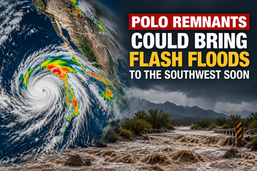
Hurricane Polo flash floods are a growing concern across the Southwest and Plains as the storm’s remnants move inland from Mexico. Polo came ashore in Baja California Sur on Monday night. By early Tuesday, flood watches covered about 28 million people, and forecasters warned the danger would rise over the next several days.
Moisture from Polo is feeding heavy rain from Arizona to Texas and north into the Plains. New Mexico and eastern Colorado face the sharpest risk Tuesday night into Wednesday, and burn scars are especially prone to dangerous runoff. Rain may continue in parts of the region through Thursday.
How Hurricane Polo Flash Floods Are Developing
Polo weakened after reaching Baja California Sur, but the moisture it carried did not disappear. Meteorologists say the remnants are being drawn north and east by a separate weather disturbance over the Southwest. The Washington Post described the setup as unusual.
The trouble started before the remnants arrived. On Monday, flash floods hit several states, including a high-water rescue near Bullhead City, Arizona. Debris flows were also reported in Utah and California.
Ground in some areas was already wet from earlier storms. That leaves less room to absorb new rain, so water runs off quickly into washes, creeks and low-lying roads.
Key Facts at a Glance
| Detail | What we know |
|---|---|
| Landfall | Baja California Sur, Mexico, Monday night |
| Flood watches | About 28 million people as of early Tuesday |
| Highest-risk states | Arizona, New Mexico, Colorado, Kansas, Oklahoma, Texas |
| Peak timing | New Mexico Tuesday night; eastern Colorado early Wednesday |
| Extra rain forecast | 3 to 5 inches in parts of the Southwest |
| Main hazard areas | Burn scars, dry washes, slot canyons, low roads |
New Mexico and Colorado Face the Sharpest Risk
According to The Washington Post, Polo’s remnants were expected to reach New Mexico on Tuesday evening and cross the state overnight. Some pockets could receive more than three Septembers’ worth of rain in a single day.
The National Weather Service office in Albuquerque used strong language in its flood watch, warning of a potential for life-threatening flash flooding. By early Wednesday, the remnants were forecast to reach eastern Colorado, where serious flooding is also possible.
Forecast offices in Pueblo, Colorado, and Albuquerque pointed to burn scars as a particular worry. Land burned by wildfire sheds water quickly, which can trigger flash floods and mud flows capable of destroying homes.
● Rainfall totals to watch
Forecasts from The Weather Company call for an additional 3 to 5 inches across parts of the Southwest. Rainfall rates could reach 1 to 3 inches per hour, a pace that can overwhelm drainage quickly.
The National Weather Service has also said repeated rounds of rain could produce up to 4 inches in places. Albuquerque, Los Alamos and Santa Fe could see up to 3 inches, and isolated spots near El Paso, Texas, could reach 4 inches, according to reports on the agency’s outlook.
Arizona and Other States Remain on Alert
The National Weather Service issued a flood watch for most of Arizona through Tuesday evening. Meteorologist Gabriel Lojero told KJZZ that higher terrain in the northern and southeastern parts of the state would likely see the heaviest rain and face the greatest flash flood risk.
Beyond the core region, several other states are also in the path. Utah, Nebraska, Iowa, Illinois, Missouri, Kansas, Oklahoma and Texas could see flooding downpours through at least Thursday. The Post reported that the rain is expected to spread eastward from Friday through the weekend, and an isolated tornado is possible.
What Happened in Mexico
Before reaching the United States, Polo brought heavy rain to Baja California Sur and mainland northwestern Mexico. Forecasters said parts of those areas could see up to a foot of rain, with a risk of flash flooding and mudslides. The National Hurricane Center warned that steep terrain was especially dangerous.
What Residents Should Do Now
Local weather service offices provide the most current alerts, and conditions can change within hours. People in watch areas should know their evacuation routes, avoid driving through moving water and keep phones charged for emergency notifications.
Anyone living below a burn scar should be especially alert. Runoff from these areas can arrive fast, even when the rain seems to be falling miles away.
Frequently Asked Questions
Where did Hurricane Polo make landfall?
Polo made landfall in Mexico’s Baja California Sur on Monday night.
How many people are under flood watches?
About 28 million people were under flood watches as of early Tuesday, according to The Washington Post.
Which states face the highest flood risk?
Arizona, New Mexico, Colorado, Kansas, Oklahoma and Texas are at highest risk into Wednesday.
Why are burn scars a special concern?
Weather service offices in Pueblo and Albuquerque say burn scars are especially vulnerable to flash floods and mud flows that could destroy homes.
How long could the flooding threat last?
Several states could see flooding downpours through at least Thursday, with rain spreading eastward from Friday through the weekend.