
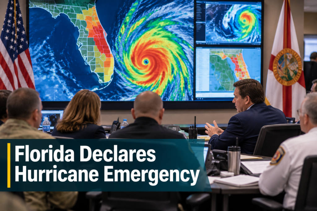
Hurricane Isaias became the first hurricane of the 2026 Atlantic season late Wednesday, and Florida is already moving to prepare. Gov. Ron DeSantis signed an executive order declaring a state of emergency in 25 counties, local reporting from CBS12 and WESH 2 in Orlando shows, while forecasters point to a landfall on the northern Gulf Coast late Friday or early Saturday.
A Late Start to the Season’s First Hurricane
The storm began as a tropical depression and was named Tropical Storm Isaias on Wednesday morning in the southwestern Gulf of Mexico, CBS News reported. It is the ninth named storm of the season. By late Wednesday night, the National Hurricane Center said Isaias had maximum sustained winds of 75 mph, which makes it a Category 1 hurricane.
The timing is unusual. ABC News noted that the storm could become the latest first Atlantic hurricane on record. The season runs through the end of November, so forecasters say the Gulf Coast still has weeks of risk ahead.
Warm Gulf waters and moist air are helping the system strengthen, according to The Weather Channel. Some local meteorologists have said Category 2 or Category 3 strength is possible before landfall, though the official forecast can change.
Florida State of Emergency: Which Counties Are Included
DeSantis signed Executive Order 26-202 on Tuesday, before the system was named. The order covers 25 counties, mostly in the Panhandle and Big Bend regions:
The governor said the order lets the Florida Division of Emergency Management stage preparedness resources so the state can respond quickly. He also urged residents to put disaster plans in place and check that their hurricane supply kits are stocked.
A state of emergency is a precaution. It does not mean damage has occurred, and it does not order anyone to leave. It mainly speeds up how supplies, crews and funding can move before a storm arrives.
Key Facts at a Glance
QUICK SUMMARY
Hurricane Isaias strengthened into a Category 1 storm in the Gulf. Florida declared a state of emergency in 25 counties as a precaution, and forecasters expect landfall between the western Florida Panhandle and the Mississippi coast. Storm surge, heavy rain and high winds are the main concerns.
Warnings, Storm Surge and Rain
A hurricane warning stretches from Ocean Springs, Mississippi, to the Bay/Gulf County line in Florida, according to CBS12. Tropical storm warnings extend west into southeastern Louisiana and east along Florida’s Big Bend. Storm surge warnings are also in effect, and officials in the affected areas are watching them closely.
Surge is often the most dangerous part of a hurricane. Water levels could rise 5 to 7 feet above ground in parts of coastal Mississippi, Alabama and the Florida Panhandle. From Indian Pass to the Steinhatchee River, the range is 4 to 6 feet.
Rain is another concern. The National Hurricane Center forecasts 3 to 7 inches along the central Gulf Coast, from southeastern Louisiana to the Florida Panhandle, with isolated totals near 10 inches, CBS News said. That could cause urban flooding and some river flooding, and the wet weather is expected to spread across the Southeast this weekend and into early next week.
Where Hurricane Isaias Could Make Landfall
The current forecast has the storm moving east-northeast before turning northeast and then north. Computer models point to a landfall somewhere between the western Florida Panhandle and the Mississippi Gulf Coast, The Weather Channel said. The center is expected to pass northwest of the Yucatan Peninsula first.
Forecasters are clear that the exact track is still uncertain. Residents from southeastern Louisiana through the Florida Panhandle have been told to follow updates, and a small shift in direction can change which communities see the worst surge and wind. After landfall, Isaias is expected to move inland over the weekend.
How Residents Can Prepare Now
Officials have repeated basic steps that apply to any hurricane. Most take little time, and they are easier to do before the weather turns.
- Review your household disaster plan and know your evacuation zone.
- Stock water, food, medicine, batteries and important documents.
- Charge phones and power banks before winds pick up.
- Follow the National Hurricane Center and local emergency managers for changes.
- Secure outdoor items that strong winds could turn into projectiles.
What Remains Uncertain
Several details cannot be confirmed yet. Final landfall location, peak intensity and the exact timing could all change as the storm moves through warm water. Reported figures for surge and rainfall are forecasts, not measurements. Reports also differ on how strong Isaias may become, so readers should rely on official National Hurricane Center advisories over any single estimate.
It is also too early to say what damage, if any, will occur in Florida. The state declaration covers counties that could feel indirect effects even if the center comes ashore farther west. This article will reflect only what verified sources have published as of Thursday, October 8, 2026.
Frequently Asked Questions About Hurricane Isaias
1. How many Florida counties are under the state of emergency?
Twenty-five counties are covered by Executive Order 26-202, mostly in the Panhandle and Big Bend.
2. How strong is Hurricane Isaias?
The National Hurricane Center put its maximum sustained winds at 75 mph late Wednesday, making it a Category 1 hurricane.
3. Where is landfall expected?
Forecasts point to the northern Gulf Coast, between the western Florida Panhandle and the Mississippi coast, late Friday or early Saturday.
4. How much storm surge could occur?
Forecasts call for 5 to 7 feet above ground in parts of Mississippi, Alabama and the Panhandle, and 4 to 6 feet from Indian Pass to the Steinhatchee River.
5. Why did the governor declare an emergency early?
DeSantis said the order lets the state’s emergency division stage resources ahead of possible impacts.